Vacadu All itineraries
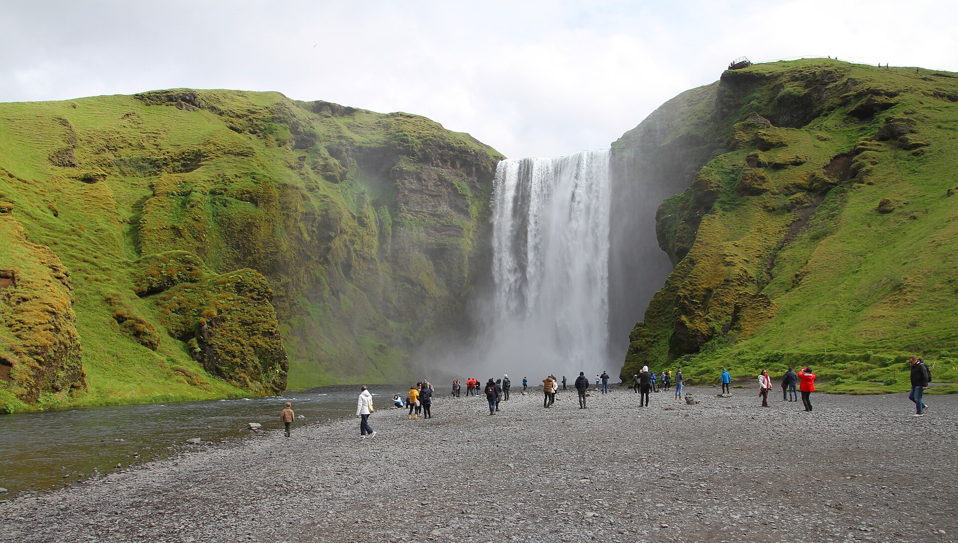
Skógafoss, Iceland
Photo: Skogafoss-02-2018-gje.jpg by Gerd Eichmann, via Wikimedia Commons (CC BY-SA 4.0).

Iceland in 8 Days: The Ring Road

Iceland's Ring Road in eight days, anticlockwise from Reykjavík: south-coast waterfalls, the glacier lagoon at Jökulsárlón, the East Fjords, Dettifoss and Mývatn, whale watching from Húsavík, and the long western run home. Honest driving times, summer only.

road-tripnatureself-drivewaterfalls

Duration
8 days
Best months
June to August
Destination
Iceland
Stops
24 places
Countries
Iceland
Cities and towns
Reykjavík, Hvolsvöllur, Vík í Mýrdal, Höfn, Egilsstaðir, Reykjahlíð, Akureyri, Borgarnes

Open this itinerary in Vacadu Plan your own trip

The itinerary, day by day

Numbered days, not dates — start it whenever you like, ideally June to August.

Day 1 Golden Circle, then south

Three classic sights out of Reykjavík, then east to the south coast.

  1. 09:30

    Þingvellir National Park

    1h 30m · Park · Nature · Landmark

    The Almannagjá rift is the one place you can walk between the North American and Eurasian plates, and it was the site of Iceland's parliament from 930. The park itself never closes. Parking is 1,000 ISK, bought once at a machine or on checkit.is and then valid all day in every lot — so park at P1 (Hakið) at the top of Almannagjá for the rift walk, or P2 (Efri-Vellir) if you only want Öxarárfoss. P5 is the far lot, for the church and Silfra.

  2. 11:45

    Geysir and Strokkur

    45m · Nature · Photo-spot

    Geysir itself has been mostly dormant for decades — the one that actually erupts, every five to ten minutes and up to 20 m, is Strokkur next to it. The field is free to walk and open around the clock, but parking has been 1,000 ISK since late 2024, so any guidebook calling this a free stop is out of date. It is the most crowded stop of the day, and the coaches thin out after about 17:00.

  3. 12:45

    Gullfoss

    45m · Nature · Viewpoint · Photo-spot

    Two viewpoints, and most visitors only use one: the upper platform by the café is level and dry, the lower path takes you along the lip of the canyon and will soak you. Parking is free and the falls are open at any hour, though the café shuts around 18:00. From here it is about two hours east to Hvolsvöllur.

  4. Overnight

    Base yourself around Hvolsvöllur

    Hvolsvöllur, South Iceland · 1 night

    A working farm town on Route 1 with no sights of its own, which is exactly the point: it is 30 minutes from Seljalandsfoss, so tomorrow starts at the first waterfall instead of in traffic out of Reykjavík. Guesthouses and farm stays along Route 1 either side of town are better value than the hotels. This night only works if you land in the morning — off an overnight flight you can be at Þingvellir by half nine. Landing in the afternoon, sleep in Reykjavík instead and roll the Golden Circle into day 2.

Day 2 South coast waterfalls

Short drive, four big stops: two waterfalls, a glacier, a black beach.

  1. 09:00

    Seljalandsfoss

    1h · Nature · Photo-spot

    The one waterfall you can walk behind, which means full waterproof trousers and grippy shoes, not just a rain jacket — the path is wet rock and spray, all of it. Parking is 1,000 ISK, the falls themselves are open at any hour. Almost everyone drives off without walking the 10 to 15 minutes north to Gljúfrabúi, hidden inside a slot in the cliff and free once you have paid to park here.

  2. 10:30

    Skógafoss

    1h · Nature · Photo-spot

    Stand right underneath a 60 m curtain of water and, on a sunny day, inside the rainbow in its spray — which needs the sun behind you, so look where it is before you set up. Parking is 1,000 ISK, new since 2025. The 527-step staircase on the right climbs to the top viewpoint and the start of the Fimmvörðuháls trail; the first ten minutes of it are worth it even if you go no further.

  3. 12:30

    Sólheimajökull glacier walk

    3h · Activity · Tour · Nature

    The most accessible guided glacier walk in Iceland — two hours on the ice with crampons. The car park is 4 km up Road 221 off Route 1, 750 ISK, and it is a further 10 to 15 minutes on foot to the ice, so arrive half an hour before your slot. Book a day ahead in summer. Never walk onto the ice unguided: the crevasses near the snout are real and the guides carry the only rope. The tongue has retreated about 1.5 km since 2000, roughly 60 m a year, and a lagoon has been growing at the snout since 2011 — which is why the walk in keeps getting longer.

  4. 16:30

    Reynisfjara black sand beach

    1h · Beach · Nature · Photo-spot

    Sneaker waves here have killed visitors: they arrive without warning, run far higher up the sand than the set before, and the water is 5°C with nothing to hold on to. A flashing sign at the entrance grades the danger and marks zones — when it flashes red, do not go past it, and never turn your back on the water at any colour. Stay well above the wet line. There is no lifeguard. The same waves kill at Kirkjufjara and below Dyrhólaey, so treat those as the same beach and not a safer one. Parking is 1,000 ISK in the lower lot, 750 in the upper, three hours maximum. Dyrhólaey's arch is 15 minutes away and 750 ISK, but in nesting season — roughly mid-May to late June — its upper gate shuts at 19:00, so that only works if you leave the beach by six.

  5. Overnight

    Base yourself in Vík í Mýrdal

    Vík í Mýrdal, South Iceland · 1 night

    The only real service town for 70 km in either direction — fuel, a supermarket, and dinner that is not a petrol-station hot dog. It also puts you five minutes from Reynisfjara, which matters because the beach is at its best in evening light. Beds here sell out first on the whole south coast.

Day 3 Canyon, glacier, ice lagoon

The route's best day and a long one — leave Vík by eight.

  1. Vík → Höfn (the southeast run)

    Car · 08:00 → 18:00 · Vík í Mýrdal → Höfn

    Times are a suggestion. About 315 km with the Fjaðrárgljúfur and Skaftafell detours and four hours of it moving, which is why the eight o'clock start is not optional: falling an hour behind at Skaftafell is what costs you Jökulsárlón in good light. Route 1 crosses Skeiðarársandur here, an outwash plain with nothing on it and a crosswind that arrives sideways. Fuel is thin between Kirkjubæjarklaustur and Höfn, so fill up at Klaustur whatever the gauge says.

  2. 09:00

    Fjaðrárgljúfur

    1h · Nature · Viewpoint · Photo-spot

    The gorge is 100 m deep and 2 km long, mossy the whole way down, reached by a short gravel spur (Route 206) that a 2WD handles fine in summer. Parking is 1,000 ISK in the Parka app. Check before you turn off: the Environment Agency closes the canyon most springs to let the trampled vegetation recover, and in some years that closure has run to 1 June, so a June visit is not guaranteed. Most people stop at the first platform; the rim path continues another 15 minutes to a much better view down the whole gorge.

  3. 11:30

    Svartifoss, Skaftafell

    1h 45m · Nature · Park · Photo-spot

    Hexagonal basalt columns frame this one, 1.5 km uphill from the Skaftafell visitor centre — allow 45 minutes each way plus time at the falls. The trail is open at any hour; the visitor centre keeps roughly 09:00 to 18:00 in summer. Parking is about 1,000 ISK in the Parka app: flat rate, valid until midnight, in and out as you like. Pay it here rather than later, because the same app then takes 50% off Jökulsárlón this afternoon, automatically. Keep going five minutes past the falls to the Sjónarnípa spur for a view over Skaftafellsjökull.

  4. 15:00

    Jökulsárlón glacier lagoon

    1h 15m · Nature · Viewpoint · Photo-spot

    Icebergs calving off Breiðamerkurjökull drift across the lagoon and out to sea. Parking is 1,000 ISK, halved if you already paid at Skaftafell today. Zodiac and amphibious boat tours sell out several days ahead in July and August — book before you leave home. Coaches dominate 10:00 to 17:00; arrive either side of that and it is a different place. If you came for an ice cave, the natural ones under Vatnajökull are a November-to-March product: in summer the only honest options are the Katla cave near Vík and the man-made tunnel inside Langjökull.

  5. 16:15

    Diamond Beach, Breiðamerkursandur

    45m · Beach · Nature · Photo-spot

    The black outwash beach on the seaward side of the same bridge, where the icebergs wash back ashore. How much ice is there depends entirely on wind and tide that day — some mornings it is spectacular, some it is bare sand, and nobody can promise you which. Never stand on or climb grounded ice; it rolls without warning.

  6. Overnight

    Base yourself in Höfn

    Höfn í Hornafirði, Southeast Iceland · 1 night

    An hour past Jökulsárlón, which breaks the long southeast run at the right point and leaves you already inside the East Fjords for the morning. It is a langoustine port and the restaurants know it — but kitchens here stop early, so ring ahead if you are arriving after nine. Stokksnes is 15 minutes east, so a clear evening is a second chance at Vestrahorn.

Day 4 East Fjords

Slow fjord roads all day, ending on Seyðisfjörður's rainbow street.

  1. Höfn → Egilsstaðir (East Fjords, Route 1)

    Car · 08:15 → 18:30 · Höfn → Egilsstaðir

    Times are a suggestion. About 250 km on Route 1 plus roughly 80 km of detours — but the honest figure is the clock, not the distance: this is single-lane bridges, blind rises and one hairpin fjord after another, so budget five hours of driving for it, not three. The Öxi pass (939) saves 60 km on gravel and is not worth it in poor weather.

  2. 08:30

    Stokksnes and Vestrahorn

    1h 15m · Nature · Viewpoint · Photo-spot

    The jagged Vestrahorn massif rises straight out of a black tidal lagoon — the most photographed mountain in the east. It is private land, and the fee is 1,100 ISK per person, not per car: pay at the Viking Café on the way in, open 07:30 to 22:00, with a card kiosk at the gate outside those hours. Check the tide before you go, because the reflection everyone comes for only exists at low water, and the light is best very early or very late.

  3. 11:30

    Djúpivogur

    45m · Landmark · Coffee · Photo-spot

    Stop here 100 km up the coast for coffee and to get out of the car, then walk the old harbour to Sigurður Guðmundsson's Eggin í Gleðivík — 34 polished granite eggs, one for each bird that nests locally, lined up along the pier stanchions and there whatever the hour. From here the fast route north is Route 1 around the coast; the Öxi pass (Route 939) cuts 60 km but is 20 km of steep gravel and shuts in bad weather.

  4. 15:30

    Seyðisfjörður

    1h 30m · Landmark · Photo-spot · Viewpoint

    Worth the 27 km detour over Fjarðarheiði from Egilsstaðir: a rainbow-painted street leading straight to the pale blue Bláa kirkjan, under waterfalls on three sides. The pass tops 620 m and can be fogbound or sleeting even in July — check road.is before committing. Avoid Thursdays, when the Faroese ferry docks in the morning and sails again in the evening and the town is full both ways. If it is a Wednesday between late June and mid-August, the church runs its summer concert series at 20:30, and in July there is still daylight to drive back over the pass afterwards.

  5. Overnight

    Base yourself in Egilsstaðir

    Egilsstaðir, East Iceland · 1 night

    The east's only proper town and the junction where the fjord roads meet Route 1 — unremarkable, but it has the supermarket, the fuel and the bed you need before the empty crossing to Mývatn. Fill the tank here tonight, not tomorrow morning.

Day 5 Jökuldalur, Dettifoss, Mývatn

A long empty drive, a blue canyon, and Europe's heaviest waterfall.

  1. Egilsstaðir → Mývatn (via Möðrudalur and Dettifoss)

    Car · 08:30 → 16:30 · Egilsstaðir → Reykjahlíð

    Times are a suggestion. About 300 km with the Stuðlagil and Dettifoss detours, and the emptiest stretch of the whole Ring Road: after Möðrudalur there is essentially no fuel, no food and patchy phone signal until Mývatn. Leave Egilsstaðir with a full tank and water in the car. Summer will not close this road, but it can make it unpleasant — check the wind on vedur.is, because blowing sand and crosswind across Möðrudalsöræfi are what turn this into a bad drive.

  2. 09:30

    Stuðlagil

    2h · Nature · Viewpoint · Photo-spot

    A basalt-column canyon with blue-green water, visible only since the Kárahnjúkar dam dropped the river level. Two sides, and they are not interchangeable: follow signs for Grund for a short walk to a steel viewing platform, or for Klaustursel for the 5 km hike each way down to the canyon floor — the better view, and four hours you do not have today. Grund means roughly 30 km of gravel farm road off Route 1: fine for a 2WD, slow. One thing decides whether the detour is worth making at all: once the Hálslón reservoir starts overflowing, usually in early August, the river turns grey-brown and the columns disappear. Check the reservoir level before you commit — June and July are the safe window.

  3. 14:00

    Dettifoss

    1h 15m · Nature · Viewpoint · Photo-spot

    Europe's most powerful waterfall by volume, and the mistake people make is choosing the bank badly: Route 862 on the WEST side is paved the whole way up from Route 1 and has the toilets and the shorter approach, while the 864 on the east is gravel and slow. Even from the west car park it is about a kilometre each way on foot. Selfoss is a 15-minute walk further upstream and half the crowd never goes.

  4. Overnight

    Base yourself at Reykjahlíð on Lake Mývatn

    Reykjahlíð, Lake Mývatn · 1 night

    The village on the northeast corner of the lake, within ten minutes of the Mývatn Nature Baths and the Krafla road, so tomorrow starts on a lake shore rather than a motorway. Dimmuborgir is ten minutes the other way: what is left of a collapsed lava lake, a maze of hollow pillars and arches, free, ungated and a 25-minute loop — do it the evening you arrive instead of spending a morning slot on it. Bring a head net, because the Mývatn midges are genuinely unbearable on a still, warm evening and every petrol station here sells one for the price of a coffee. Rooms are few and they go early; if Reykjahlíð is full, look along the south shore rather than jumping to Húsavík.

Day 6 Craters, whales, Goðafoss

Craters before the crowds, whales from Húsavík, then Akureyri.

  1. 07:30

    Krafla and Víti crater

    1h 30m · Nature · Viewpoint · Photo-spot

    Víti is a milky blue crater lake and Leirhnjúkur a field of steaming, colour-stained lava, both off the short spur road 863 — which only opens once the snow clears, usually in June. Nothing up here is staffed, gated or ticketed, which is why it is worth an early alarm: at half seven you will have it to yourself, and it is twenty minutes back down from Reykjahlíð. Stay on the marked paths, because the crust over the vents is thin. Hverir's mud pots sit right on Route 1 on the way back and cost nothing but the smell.

  2. 10:30

    Húsavík whale watching

    3h 30m · Activity · Tour · Nature

    Skjálfandi bay runs a 97 to 99% sighting rate in summer: humpbacks throughout, minke and white-beaked dolphins, and blue whales if you are here between mid-June and mid-July. The traditional three-hour oak-boat trip is about 12,000 ISK a head — the biggest single cost of this trip, so decide before you arrive rather than at the pier. Book a morning sailing: the whales are more active and the afternoon wind gets up. They hand out overalls, and you will want them.

  3. 15:00

    Goðafoss

    45m · Nature · Photo-spot · Viewpoint

    Route 1 runs within sight of it, which makes this the highest reward-per-minute stop on the whole Ring Road — and both car parks are free and open around the clock. They sit on opposite banks, joined by a footbridge: the west side gives the classic curve, the east side gets you closer to the water and is usually emptier.

  4. Overnight

    Base yourself in Akureyri

    Akureyri, North Iceland · 1 night

    Iceland's northern capital, and after five nights in villages the return of restaurants, a pool, a bookshop and a bar is worth planning for. If you arrive with daylight left — and in July you will — the botanical garden ten minutes uphill is free and its gates stay open until 22:00 from June to September: arctic and alpine planting at 65°N, oddly moving after five days of lava and ice. Then eat well and turn in, because tomorrow is the longest drive of the trip and you want to leave early.

Day 7 The long run west

The trip's longest drive, about 415 km, with just two deliberate stops.

  1. Akureyri → Borgarnes (the long western leg)

    Car · 08:30 → 17:30 · Akureyri → Borgarnes

    Times are a suggestion. The single longest drive of the trip — about 415 km once Hvítserkur's gravel is counted, and five and a half hours moving, which is why today has only two stops rather than four. The one thing to know: high crosswinds on the open Holtavörðuheiði moor are the classic place an Icelandic car door gets torn off its hinges, and no rental insurance covers wind damage. Hold the door whenever you open it.

  2. 10:00

    Glaumbær turf farm

    1h · Museum · Landmark

    A row of grass-roofed turf houses in Skagafjörður, furnished as they were left, and the clearest picture you will get of how Icelanders actually lived until the 1940s. Open daily 10:00 to 18:00 from 20 May to 20 September, so there is no shut weekday to dodge — but do not arrive before ten, because the door is locked until then. Adults 2,000 ISK, children free. It goes first because everything after it today is distance.

  3. 12:30

    Hvítserkur

    1h · Nature · Photo-spot · Viewpoint

    A 15 m basalt sea stack that looks like a drinking animal, streaked white by generations of nesting birds. Be honest about what it costs: Route 711 up Vatnsnes is itself the gravel road, 28 km and half an hour each way off Route 1, so this is close to two hours out of the longest driving day of the trip. It is also the trip's longest run on loose surface — slow to 60 before the tarmac ends rather than after, because a flung stone through the windscreen is the one bill standard rental cover leaves you holding. Go at low tide and you can walk out onto the sand for the view everyone photographs; seals usually haul out in the same bay. If you are running behind, this is the stop to drop.

  4. Overnight

    Base yourself in or near Borgarnes

    Borgarnes, West Iceland · 1 night

    Stopping here instead of pushing all the way to Reykjavík is what makes the 415 km western leg survivable, and it puts Hraunfossar and Deildartunguhver 45 minutes away for the morning. Plenty of farm accommodation up the Borgarfjörður valleys, usually cheaper than the town itself.

Day 8 Borgarfjörður, then Reykjavík

Lava-spring waterfalls, Europe's highest-flow hot spring, then the capital.

  1. 09:30

    Hraunfossar

    45m · Nature · Photo-spot · Viewpoint

    Not a river falling over a cliff but hundreds of springs seeping straight out of the face of the Hallmundarhraun lava field, a kilometre wide and startlingly blue. Free parking, no gate, any hour. Barnafoss is a five-minute walk upstream through the birch and most people never bother — go, it is the more violent of the two.

  2. 10:45

    Deildartunguhver

    30m · Nature · Landmark

    Europe's highest-flow hot spring: 180 litres a second at 97°C, seen for free from a short boardwalk, and piped 34 km to Borgarnes and 64 km to Akranes — the longest hot-water pipeline in Iceland, still near 80°C when it arrives. Stay behind the rail; this is boiling water, not a bathing spring. Krauma next door is where you actually get in, daily from 11:00 to 21:00, if you want one last soak before the airport.

  3. 13:30

    Hallgrímskirkja

    1h · Landmark · Viewpoint · Observatory

    Finish where you started, with the best cheap view in Reykjavík: a lift up the 74 m tower, 1,500 ISK, for a 360° look over the coloured roofs and out to Esja. Open 09:00 to 21:00 in summer with the last ascent at 20:30, and shut on Sunday mornings for the 11:00 service, roughly 10:30 to 12:15 — an afternoon slot dodges both that and the worst of the queue. Skólavörðustígur, the street running downhill from the door, is the one to walk.

  4. Overnight

    Base yourself in central Reykjavík

    Reykjavík 101, downtown · 1 night

    One night in the 101 postcode to close the loop on foot — the harbour, Skólavörðustígur and dinner all within walking distance, so the car can go back the moment you arrive. Ask whether parking is included before you book: downtown street parking is paid and tight.

Good to know

  1. Before you drive

    road.is for closures, vedur.is for the wind warning, safetravel.is for alerts — every morning before you set off. Install the 112 app. Emergency 112, or 599-0112 now that 2G and 3G are off.

  2. Left out

    No Snæfellsnes (needs a day of its own) and no Blue Lagoon (wrong side of the airport, and it shuts with the Reykjanes eruptions). Soaks already on route: Mývatn Nature Baths, Krauma.

  3. Pace

    Fast. One night per base, 3 to 5 hours behind the wheel most days. Eight days on the road plus a last night in Reykjavík, so you need nine mornings; day 1 starts driving at 08:30.

  4. Stay

    Guesthouses and farm stays in small towns; book by February for a July or August trip

  5. Transport

    A rental car is essential; a 2WD is enough — no F-roads. Budget the 2026 per-km road tax (about 1,550 ISK a day) and gravel-and-sand cover: Routes 206, 711 and 923 are gravel.

  6. Travelers

    Two to four adults who can share the driving — this route is too much for one driver

Open this itinerary in Vacadu

More ready-made itineraries

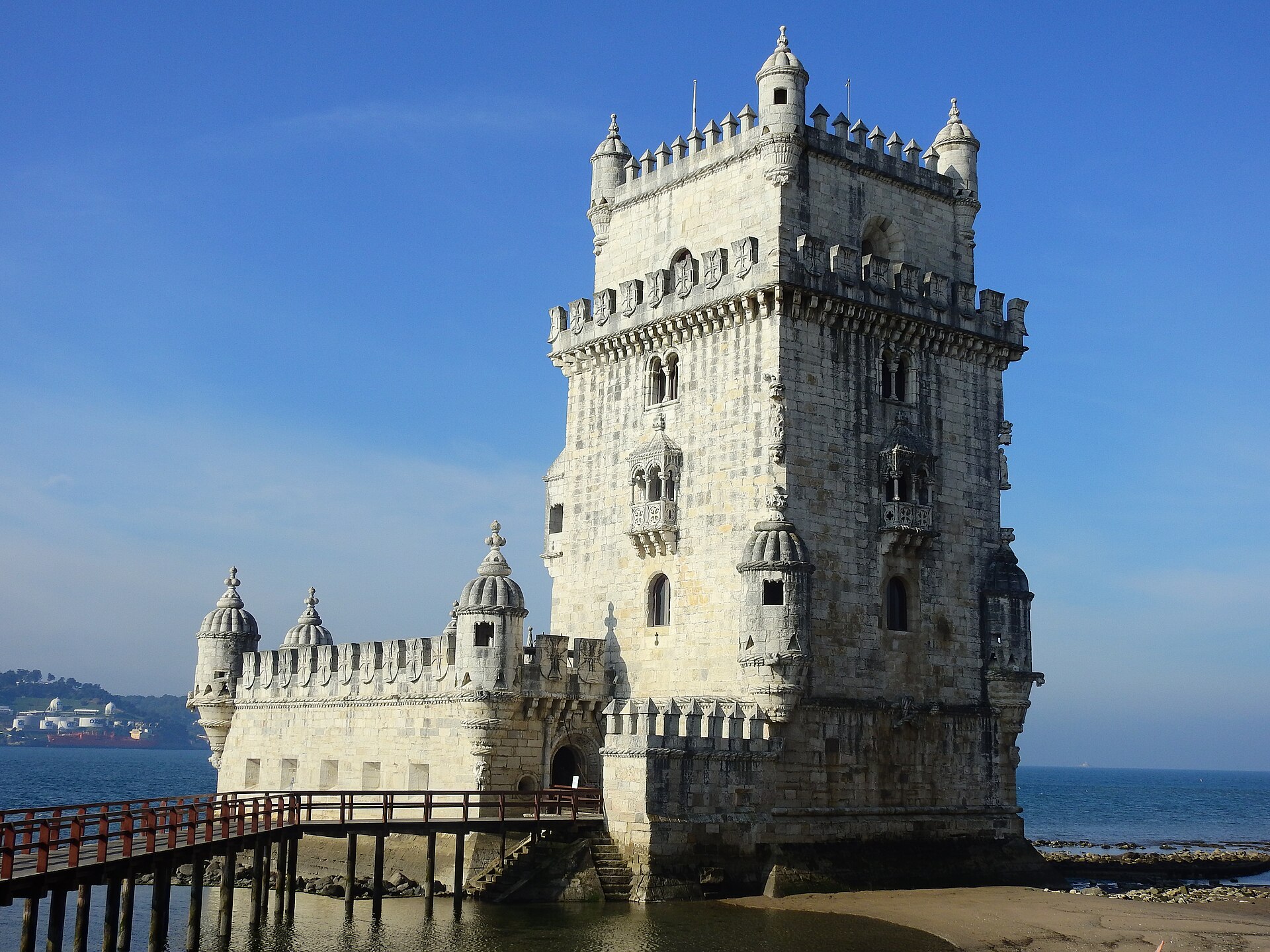
Photo: Rehman Abubakr (CC BY-SA 4.0)

Portugal in 8 Days: Lisbon to Porto

Portugal · 8 days

Eight days north by train: Belém and Alfama, a full day in Sintra, the Baroque Joanina Library in Coimbra on the way, then Porto's tiled centre, a Douro Valley rail day, and the port cellars of Gaia.

first-timercitiesfoodtrains

How these itineraries are made

Every itinerary here is written as a real plan, then checked stop by stop before it is published: walkable distances, opening seasons, honest travel times, and two to four stops a day rather than a checklist. Nothing on this page is sponsored or paid for.

Days are numbered, not dated, so a plan never goes stale — open it in the app and it lands on real dates you can change. Coordinates come from Wikidata, and photos from Wikimedia Commons under the licence credited beside each image.

Spotted something out of date? Tell us: trips@vacadu.com.

More on where the coordinates and photos come from, and what to re-check before you go.